Workshops and Seminars
Visualization and Remote Sensing in the Arts and Humanities: an Access Grid Support Network Workshop Report
Report by C. Gaffney, V. Gaffney and H. Goodchild
Introduction
Remote sensing and visualization is a strategic and vibrant area of research which informs many areas of the arts and humanities. Whether this data is derived from the surface modelling of structures and objects, ground-based geophysics or the expanding array of sensor types it is clear that many disciplines have a requirement for access to high quality, remotely-sensed data. Beyond that need is the expertise to visualize and re-present this information through increasingly complex softwares and augmented or virtual environments. However, the visualization and remote sensing community in the arts and humanities is highly dispersed and there are only a few centres where this capability exists. These islands of expertise are found in a range of educational and governmental institutions both within Britain and abroad, but also within commercial groups that develop hardware and software for the community. The consequence of the geographical dispersal and the range of disciplines involved is that there are few professional meetings at which these groups gather as a community, and the potential to share experience or disseminate best practice between groups is rarely achieved. This situation is becoming increasingly critical as data sets expand and computing facilities and softwares anticipate distributed processing requirements through the Grid or associated strategies. This project seeks to challenge this unsatisfactory situation through the creation of a distributed research network that brings researchers, and software and hardware developers together to discuss research methodologies and solutions.
Access Grid technology allows for simultaneous, interactive seminars with a number of centres world-wide. It consists of multimedia display (PowerPoint/white boards); presentation and interactive environments; and interfaces to both grid middleware and visualization environments. As a consequence the Access Grid supports large-scale distributed meetings, collaborative work sessions, seminars, lectures, tutorials and training for groups located in the UK and/or abroad. The Access Grid’s primary value is group-to-group communication and is increasingly characterised by efficient delivery with low latency. Access Grid nodes are ’designed spaces‘ that explicitly contain the high-end audio and visual technology needed to provide a high-quality user experience, but there is also the potential for desktop delivery across personal nodes. Given the increasing pervasiveness of the technology (http://www.accessgrid.org/community/nodes/nodes.html) , the Access Grid is potentially one of the most important distributive e-learning tools currently available with the potential to permit harmonisation of curricula across institutions and time zones. This was demonstrated in a recent report to the Higher Education Academy on’Establishing Collaborative Postgraduate Research Programme and Integrated Teaching Agendas Using the Access Grid‘ (http://www.hca.heacademy.ac.uk/resources/TDG/reports/Gaffney-AccessGrid.php). The increasing use of the Access Grid at all levels of education may also be seen in the recent collection of case studies prepared as part of the NSF-funded ’Engaging People in Cyberinfrastructure (EPIC)’ project (http://www.accessgrid.org/node/477), as well as a recent initiative – eSI Thematic Programme: e-Science in the Arts and Humanities – held at the e-Science Institute in Edinburgh and over the Access Grid (http://www.nesc.ac.uk/esi/events/785/).
The Institute of Archaeology and Antiquity/Visual and Spatial Technology Centre (VISTA) is well suited for the project as it maintains:
- Two Access Grid Studio nodes and dedicated virtual venues
- Partnerships with market leaders in remote sensing and visualization hardware and software and including leading edge partners in Grid development
- Partnership with the Birmingham large cluster (1000 node) and the White Rose Grid
- UKLight membership
- Support staff with considerable experience in managing Access Grid seminars and sessions Report
Network goals
- The network is dedicated to the dissemination of good practice and innovation in the field of visualization of remote-sensed data in the arts and humanities.
- Participants include arts and humanities researchers, and software and hardware developers with an interest in visualization and with particular reference to Grid computing.
- The network is based around one initial network meeting and seven seminar meetings over a year in which critical issues will be defined and developed.
- The provision of Access Grid kits to support specific research groups or individuals was part of the proposal.
- Network meetings are open to any relevant group with an Access Grid capacity
Account of the activity
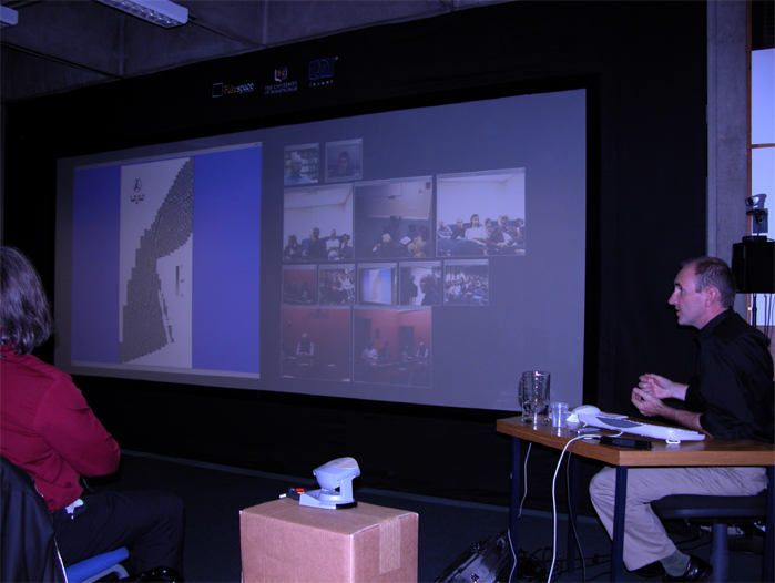
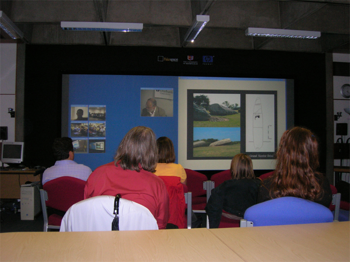
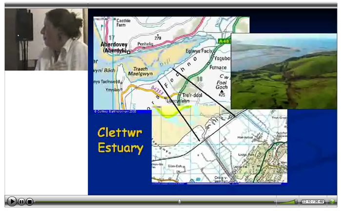
Much of the activity related to this project was the setting up of partners with the Access Grid facility. Whilst some partners had access to designated Institutional Access Grid nodes (see Figs. 1. and 2.), most were set up with smaller-scale free software on their desktop computers. Set-up took a minimum of two hours per person and in some cases was not possible due to limitations with individual Internet connections. This was, however, limited to only a few participants and most were able to participate from their desktop computers using the basic equipment described above.
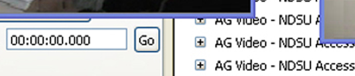
The seminars themselves were extremely successful and well-attended (see below). They were also recorded using Camtasia screen capture software. These videos were then processed and turned into streaming video for mounting on the Network website. Processing was extremely computer-intensive, requiring a very high specification computer, as file size was large given the length of the seminars (typically 45mins to 1 hour duration). Video was output as Flash files which could be streamed easily via the Internet (see Fig. 3).
Seminar papers
- Meg Watters (University of Birmingham) Through an anomaly, darkly: new perspectives on archaeogeophysics. 11 October 2006.
- Dr Chris Gaffney. Geophysics and Remote Sensing: their role and future within Archaeology. 25 October 2006.
- Professor Dominic Powlesland (Landscape Research Centre) Archaeological prospection at West Heslerton. 5:15 (UK Time), 17 January 2007.
- Simon Davies. Neolithic Avebury: an exercise in digital landscape modelling. 24 January 2007
- Keith Challis (Birmingham Archaeology/HP VISTA). Airborne remote sensing in alluvial environments. 31 January 2007.
- Dr Michael Doneus (University of Vienna) Airborne Laser Scanning as a tool for archaeological prospecting in forests. 28 February 2007.
- Professor Tony Wilkinson (University of Durham). Modelling Mesopotamia: Linking field data and agent-based models to simulate the development of agricultural communities. 6 June 2007.
Special event: North Sea Palaeolandscapes Conference 14 March 2007
This special Access Grid event was dedicated to the results of the ALSF sponsored North Sea Palaeolandscapes project and the archaeology and geomorphology of the southern North Sea. The seminar presented the results of the mapping of over 23,000 square kilometres of Holocene land surfaces within the Southern North Sea. The results of the project are of interest to archaeologists, geomorphologists and heritage managers with interests in the many countries that bound the North Sea Basin. The seminar included presentations on the archaeology, technology and heritage implications of the study.
- Professor Vince Gaffney and Dr Ken Thomson (Birmingham). Introduction.
- Dr Ian Oxley (English Heritage). English Heritage and the North Sea Palaeolandscape Project.
- Professor G. Bailey (Durham). The larger archaeological context of the North Sea Palaeolandscapes Project.
- Dr Mark Bunch (Birmingham). Data issues for the exploration of inundated land surfaces within UK waters.
- Dr Ken Thomson (Birmingham). The geological background and 3D Seismics as a tool for the exploration of inundated palaeolandscapes.
- Mr Simon Fitch (Birmingham). Integrative technologies used in the North Sea palaeolandscapes.
- Dr Ken Thomson (Birmingham). Salt tectonics and the internal structures of the Outer Silver Pit.
- Simon Fitch (Birmingham). An atlas of the palaeolandscapes of the southern North Sea.
- Dr David Smith (Birmingham). Environmental issues relating to the southern North Sea.
- Professor Vince Gaffney (Birmingham). Heritage and landscape characterisation issues.
- Professor Martin Bell (Reading). Final Considerations.
Associated lectures
Several parallel IAA Access Grid Landscape seminars ran alongside the formal network series which contained relevant content. These included:
- Paul Garwood (Birmingham). Axis Mundi: landscape, seascape, power and order in the Middle Bronze Age of south-east England.
- Jo Dyson (Birmingham). Castles and Landscapes: King Edward I Castles in Wales, a GIS approach.
- Dr Roger White (Birmingham). The Clee Hills: Industrial landscapes and prehistoric monuments.
- Machteld Bats (University of Ghent). The Flemish Wetlands. An archaeological survey of the valley of the River Scheldt.
- Professor John Haldon (Princeton). The Avkat Project.
Participants
Interest in the seminars came from a wide variety of people, from both industry/research and educational institutions. Those listed, however are only those who successfully attended a meeting.
UK
- Glasgow University
- Geomatrix
- Wessex Archaeology
- University of Bradford
- University of York
- Air Photo Services
- University of Durham
- Landscape Research Centre
Europe
- University of Leiden
- Institute of Prehistory, Poznan University, Poland
- University of Ghent
- University of Vienna
US/Canada
- University of Calgary
- Archaeological Prospectors, New Brunswick, Canada
- Minnesota State University
- Glen A. Black Laboratory of Archaeology, Indiana
- University of Arkansas
The North Sea Conference attracted a wider audience with the addition of the following institutions:
- University of Cambridge
- British Geological Society, Edinburgh
- University of Reading
- Tigress
- CEFAS
- Southampton Oceanography Centre
The total remote audience for this conference was more than 30 plus c. 40 people attending in person at the University of Birmingham. However, this represents a minimum attendance.
Outcomes
Whilst the series has not yet concluded, there seems little doubt that the project has been a success and has attracted a wide international and national participation across institutions. It is clear that the technology is capable of being used fruitfully for this purpose, although the fact that Birmingham could not control events beyond the local network could be problematic. It is a fact that the technology will always be prone to external disruption. The final stage of the project, providing streamed videos of the seminars is currently underway. In many ways this was the most problematic area. The low cost video capture and editing software available to the project may not prove appropriate. Virtually every recording faced difficulties relating to network traffic and video card compatibility issues. Unfortunately, the centrally provided AG recording softwares do not capture IGPix output and this is an issue that should be resolved at national level. Providing public access to the available video output will be a priority. Edited videos will be available at: http://www.iaa.bham.ac.uk/Computing/HP_VISTA/Seminars/video/Access_Grid_Video_Seminars.htm
At a secondary level the availability of the Access Grid and the increased levels of communication offered during this network programme provided support for the successful international JISC/EPSRC/AHRC E-Science GRID application ‘Medieval warfare on the GRID’ (http://www.iaa.bham.ac.uk/research/fieldwork_research_themes/projects/logistics/Manzikert/Index.htm). Additionally, the increased awareness of the capabilities of the Access Grid to deliver seminars containing relevant and up-to-date technical data has encouraged the International Society for Archaeological Prospection (ISAP - http://www.bradford.ac.uk/archsci/archprospection/menu.php?1) to endorse the seminar series. ISAP regularly advertises and comments on the visualization seminars in its quarterly newsletter. Related societies including the Aerial Archaeology Research Group (http://aarg.univie.ac.at/) have expressed an interest in future participation.
Institute for Archaeology and Antiquity
Institute for Archaeology and Antiquity
University of Birmingham
Edgbaston
Birmingham, West Midlands
United Kingdom
http://www.iaa.bham.ac.uk/Computing/HP_VISTA/HPindex.htm
AHDS Methods Taxonomy Terms
This item has been catalogued using a discipline and methods taxonomy. Learn more here.
Disciplines
- General
- Archaeology
Methods
- Data Analysis - Visual analysis/visualisation
- Data Analysis - Virtual quantity surveying
- Data Analysis - Predictive spatial modelling
- Data Analysis - Record linkages
- Data Capture - Digital remote sensing
- Data Capture - 2d Scanning/photography
- Data Capture - 3d Scanning
- Data Capture - Digital aerial photography
- Data Capture - Geophysical survey
- Data Capture - GPS/total station surveys
- Data Capture - Usage of existing digital data
- Data Structuring and enhancement - 3d modelling - vector
- Data Structuring and enhancement - Data modelling - flat/rectangular
- Data Structuring and enhancement - Geo-referencing/projection
- Data Structuring and enhancement - Graphical rendering
- Communication and collaboration - Video-based interaction - synchronous
- Data Analysis - Photogrammetry
- Communication and collaboration - Audio interaction - synchronous
- Data publishing and dissemination - Streaming audio
- Data publishing and dissemination - Streaming video
- Strategy and project management - Documentation